Dam decommissioning: old dams, new opportunities
While many dams have very long lives, and could in theory operate for centuries, some dams reach a point at which decommissioning becomes a realistic final phase of the dam life cycle.
Decommissioning is not something that happens very often, given the significant value of dams and their functions, which are often multiple. Maintaining and upgrading dams, rather than decommissioning, can sometimes also be a more sustainable solution if this extracts more economic, social and environmental value to offset the initial impacts that the dam may have caused when originally constructed.
However, decommissioning may be the best option if the dam is no longer needed to deliver its original purpose, if it is no longer providing commercial or societal benefits, or if it is considered too costly to continue maintaining the dam or to undertake the necessary upgrades to stay compliant with contemporary regulations and standards.
How is a decision to decommission made?
The decision to decommission a dam is usually based on a comprehensive risk assessment. Risk assessments play a critical role in managing dams throughout their life cycle. They primarily focus on ensuring safety and minimising risks associated with dam operation, failure and decommissioning.
Risk assessments estimate risks, identify hazards and failure modes, evaluate the tolerability of the risk, compare potential risk reduction measures if needed, and establish a risk reduction strategy.
If the risk is not tolerable, risk reduction measures will be recommended, and a risk reduction strategy will be established to reduce the risk. The risk reduction measures will generally involve upgrade works. When the option to undertake dam upgrade works is considered, the option to decommission the dam is often also included. The dam owner can then undertake a cost–benefit analysis to determine the most viable option, understand the level of risk reduction achieved, and consider less tangible aspects such as community concerns.
What’s involved in decommissioning a dam?
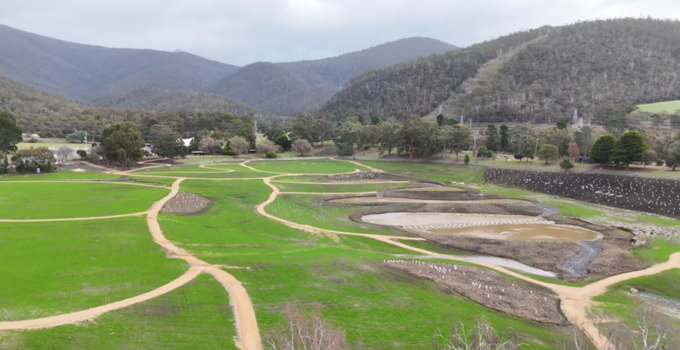
Decommissioning a dam requires considerable planning to minimise environmental impacts and reduce the chance of leaving any residual hazards in the long term. A thorough assessment of the site conditions and downstream environment is a crucial first step towards identifying the appropriate decommissioning actions.
The location of the dam and the details of the dam works will determine the planning requirements, which often include:
- engineering design – taking breach width and batters into account to remove the possibility of retaining water, and assessing the impact on flooding downstream (as dams frequently provide flood mitigation even when this is not their primary function)
- sediment and erosion control planning – as sediment release can cause significant water quality issues and harm to habitats downstream. It is important to note that the reservoir area will initially be unvegetated and will not have any topsoil that can be used to support vegetation growth to control erosion. Additionally, sediments will typically have been deposited in the dam reservoir and are generally very easily remobilised, so this needs special attention from the designers
- flora, fauna and cultural heritage studies – as decommissioning can dramatically alter ecosystems both upstream and downstream, and heritage features can often be highlighted improving the amenity of the new asset. Ecological studies such as flora and fauna assessments are important to identify any threatened species that need to be considered in the decommissioning plans, such as through exclusion zones or timing the works to minimise impacts (e.g. conducting work outside of breeding seasons)
- fluvial geomorphology assessment – which identifies how rivers interact with their landscapes and how they change over time. It is important to understand this given that the decommissioned dam will have water flowing through it rather than retaining water, changing the balance of erosion and sedimentation processes
- dam safety emergency plan for decommissioning works – to protect communities from flooding during the decommissioning works
- regulatory approvals – a dam decommissioning permit will be needed, which will include managing any specific regulatory requirements such as issuing a notice of intent prior to commencing works and providing work-as-executed reports and drawings at the completion of the works to confirm all conditions have been successfully met.
- Depending on the use and location of the dam, it is recommended to consult with a range of stakeholders, including the local community and council, during the planning process to ensure that their perspectives and concerns are considered early. If the dam is located near to residences, public spaces or other civic amenities, extensive consultation is likely to be needed due to the potential nuisance from the works (e.g. noise, dust and additional traffic in the local area). A masterplan can be developed through this process of consultation, outlining potential options for remediating and repurposing the area based on the community’s priorities, such as creating potential new community assets such as wetlands, parks or sporting facilities.
The work involved in decommissioning a dam will depend on the type of dam and the surrounding environment but commonly involves:
- re-routing inflow away from the reservoir or past the dam
- removing all or part of the dam wall
- modifying or removing the outlet works
- lowering the spillway crest level or removing the spillway control gates or stop-boards
- treating retained liquid prior to discharging it in a safe condition
- stockpiling and stabilising accumulated sediments from within the reservoir
- removing or encapsulating impounded material, such as trees and vegetation
- revegetating the reservoir area and rehabilitating the site to perform its new purpose.
Doing it safely
Decommissioning a dam is a very complex matter involving many stakeholders and often taking some time to reach its conclusion, so it is prudent for dam owners to embark early on some interim measures to rapidly reduce any identified dam safety risks. The simplest and most cost-effective risk reduction measure is usually to lower the level of the reservoir.
The next stage is identifying the planning requirements and works involved with decommissioning and developing a decommissioning plan. The engineering design, included in the decommissioning plan, will consider the necessary environmental assessments and ensure adherence to appropriate guidelines.
Common considerations when developing the engineering design include:
- hydrological and hydraulic assessment of conditions before and after decommissioning
- the necessary breach width and batters to make the site safe
- safely discharging or removing retained water and material
- the volume of any attenuated water remaining after decommissioning
- gradient of the land if the reservoir is being completely drained
- erosion and sediment control during and after decommissioning
- managing inflows and floods during the decommissioning
- careful consideration of the final land use after decommissioning including the ecological restoration and community uses.
Achieving success
For decommissioning to be considered successful, it’s crucial that the decommissioning plan and engineering design take account of the priorities that emerge from stakeholder consultation. Many communities become attached to a dam as part of their local landscape, especially if the dam is very old. They may wish for some of the dam’s heritage to be retained or acknowledged in some way, such as retaining and integrating parts of the abutment into the future form or land use where it is safe to do so, or echoing the past by incorporating smaller water features into the resulting site.
Another major consideration for successful decommissioning is controlling erosion and sediment. Reservoirs typically have a low point that can function as a temporary sediment basin once the water level is substantially lowered. Rainfall and inflows can be channelled with small bunds and hessian silt rolls to the sediment basin. Turbid water can then settle or be treated, if necessary, before being pumped out. After decommissioning, erosion and sediment can be managed by revegetating exposed areas with native plants, creating habitat features such as wetlands or log jams, and managing and monitoring wildlife to ensure their adaptation to the changing environment. Simple solutions can be implemented to achieve positive – or at least neutral – outcomes for biodiversity.
Right process, right people
Decommissioning dams takes a wide range of skills to deliver a successful outcome – from hydrology and hydraulics, environmental and heritage assessments, through to detailed construction planning and a vision for the repurposed land. With the right people and process, decommissioning can reduce safety risks to the community, protect the environment during the works, and ultimately create new, sustainable assets enhancing the amenity of the area for the benefit of communities now and long into the future.
Entura has been involved in a number of dam decommissioning projects including Waratah Dam and Tolosa Dam. To talk with Entura’s specialists about a dam decommissioning project, contact Richard Herweynen or Phillip Ellerton.
ABOUT THE AUTHOR
Joey Scicluna is a civil engineer, who began his career managing commercial and subdivision projects. Since joining Entura’s dams and geotechnical team in 2022, he has undertaken a wide range of dam safety surveillance inspections and reporting, dam safety modelling and analysis and risk assessments. Joey has been the lead author for a number of intermediate and comprehensive dam safety reviews, and has developed design concepts and conducted feasibility studies for existing and new dams projects. Joey enjoys problem solving and working with stakeholders to achieve the best outcome for every project.
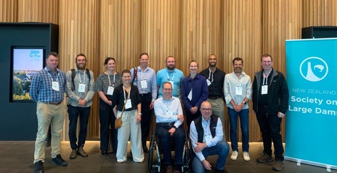
Risk is the word – reflections on the NZSOLD/ANCOLD 2025 conference
From 19 to 21 November 2025, industry experts from consultants to asset owners gathered in Ōtautahi Christchurch, New Zealand, to exchange insights, challenge thinking and strengthen connections ‘across the ditch’ and beyond. Here Entura’s Sammy Gibbs reflects on the conference …
If I had dollar for every time I heard the word ‘risk’ across the two-day event, I might have been able to fund next year’s conference myself!
Why was this the case? As noted in many of the presentations and papers, the dam industry is facing the combined challenges of aging dam infrastructure, changing design standards, climate change impacts, community expectations and resource/cost constraints. As a result, the industry is shifting more towards risk-informed decision-making/frameworks, compared to traditional standards-based approaches,to manage and design dam infrastructure.
No dam is 100% safe and all risks can never be designed out entirely, but a sophisticated understanding of their risk can inform our decisions and actions so that we can target key issues cost-effectively and ensure resilience in our dams and water infrastructure.
Risks in asset ownership
In his opening address, Andrew Watson, Director of Dam Safety & Generation Asset Planning at BC Hydro in Canada, provided valuable insights into how BC Hydro uses a risk-informed framework to manage its dams. He discussed the use of a ‘vulnerability index’ to understand the significance of identified physical deficiencies in the dam portfolio. The higher the index, the greater the likelihood that the deficiency would result in poor performance. This index allows BC Hydro’s dam safety team to understand the overall risk profile and prioritise future works. It left us contemplating how the ANCOLD 2022 Risk Assessment Guidelines and ALARP process may be enhanced by integrating components of this approach. This could be a useful way of measuring how far the dam is from meeting ‘best practice’ and hence enhance the justification for further risk reduction or accepting the position as ALARP.
Later in the conference, Andrew Watson was joined by Peter Mulvihill, Lelio Mejia and Barton Maher to discuss legacy risk and how to manage it. Legacy risk is relevant for many asset owners (nationally and internationally) as our sector faces the complexities of inheriting aging facilities, acquired from past organisations/owners. A key challenge with these legacy structures is the transfer of knowledge to new asset owners. Important records such as monitoring data, design and construction information are often lost (or were never developed), making it difficult to understand and quantify the current risk position of the structure. These aging facilities are also unlikely to meet current design standards or withstand climate change impacts. Risk-informed decision making and phased approaches become critical in such instances, as does asking the question ‘Does it matter?’ when it comes to unknowns. Like tying surveillance programs to key failure modes, unknowns should also be associated with credible failure modes.
It was noted that for some of these structures the most appropriate solution is decommissioning, as the risk imposed by the structure (and the cost to mitigate it) may outweigh the economic benefit of the asset itself. In such instances, this decision can provide social and environmental benefits and are worth investigating.
Risk in surveillance monitoring
The conference reaffirmed the critical role of risk-based surveillance monitoring and the importance of understanding how dam instrumentation relates to key failure modes and/or performance. The most effective tool to support this is an event decision tree.
Entura’s Diego Real reiterated the importance of understanding key failure modes when implementing instrumentation upgrades. His paper presented a staged approach for the upgrades, providing clients with a cost-effective, practical solution that assists in managing dam safety risks.
Although there was discussion about various ways in which surveillance programs can be optimised, our industry is aligned in recognising the criticality of undertaking routine inspections as the first line of defence when it comes to identifying potential failure indicators.
Risk mitigation solutions
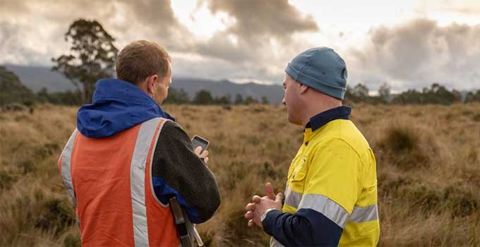
Several presenters shared examples of bespoke solutions responding to dam risks – including Entura’s Jaretha Lombaard, who highlighted how a Swedish berm was used to mitigate risks associated with piping failures at an earth and rockfill embankment dam in Tasmania.
Other risk mitigation solutions presented included non-physical works such as improvements in surveillance and monitoring. In one example, alarm systems in rivers are being used effectively to warn and evacuate the public in a swimming pool downstream in the event of a flood. Instead of relying solely on costly capital-intensive physical upgrades, the most effective strategy for reducing societal risks may lie in enhancing the speed and reliability of early warning systems.
Sharing knowledge to tackle similar problems
NZSOLD/ANCOLD 2025 was an excellent opportunity to see how specialists are tackling the complex challenges facing the dams industry. Walking away, my mind was full of phrases involving the word ‘risk’, but I felt reassured that we are all facing similar problems and by sharing our knowledge and innovations we’re continually improving our ability to design, monitor and maintain dams.
This conference will be a tough act to follow, but I look forward to the 2026 ANCOLD conference to be held in Lutruwita/ Tasmania (where I live and Entura originated).
ABOUT THE AUTHOR
Sammy Gibbs is a civil engineer with 7 years of consulting experience and joined Entura’s Dams and Geotech Team in May 2021. Sammy has a diverse background in dam and water engineering and works on a range of projects including consequence category assessments, hydrology studies, hydraulic design, risk assessments and dam design projects.
Don’t let COVID-19 stop your project
A vital part of the success of all projects, whether they are new or operational, is maintaining progress towards milestones and retaining currency in the social and regulatory realms. How can we achieve this during a global pandemic?

With the COVID-19 crisis affecting people and businesses across the globe, employers and employees alike are racing to find normalcy. Fortunately for Entura, we’ve already been working and collaborating virtually for many years across country and state borders, with dispersed office, client and project locations. So, even though our teams are working from home, it is still business as (mostly) usual, in unusual times!
Although COVID-19 hasn’t thrown us completely, travel restrictions have pushed us to think differently about many of our projects and methods. This is the time to explore proactive ways to ensure projects do not come to a grinding halt or fall off a community’s or regulator’s radar.
Keeping environmental and planning projects moving forward
Entura’s environment and planning team works frequently in the field – lakes, forests, roadsides, development sites and many more – so COVID-19 travel restriction have taken a hit at our ability to undertake survey and monitoring programs or to conduct site visits, but it hasn’t led to tools down.
We may miss out on our chance to hit the frosty outdoors this autumn and winter, but there are still many ways that we can and will continue to make progress and deliver value. It’s about thinking creatively about how we can be proactive. And that means finding measures and activities for the short and medium term that will keep the project moving towards the longer term project milestones and goals (without the anticipated longer term extending into the much further horizon!)
For example, there are proactive things we can do to prepare us better for when we can once again visit the site. We have access to a wide range of data and can undertake thorough desktop investigations early in the project. We will then be able to step on site well prepared and looking to fill knowledge gaps or to verify what should be there. That puts us in a better position to be alert to anything unexpected we might find when we’re physically on site in future. Unusual discoveries and observations will be more pronounced. Such approaches can help shorten project timelines post-COVID-19 compared with the inevitable blowouts that would be caused by downing tools completely.
Policy and regulatory reforms are also still happening across the country – some as a result of COVID-19, others associated with larger reform programs to update antiquated legislation. Our discipline experts continue to engage with the regulators and relevant government agencies and authorities to ensure we understand the nuances of these changes and how they may influence the scope of existing and future projects and programs of work.
More proactive, less reactive
The restrictions caused by COVID-19 have highlighted the need to be proactive so that we can be better positioned for the longer term. It’s natural for a consulting paradigm to tend towards the reactive and process-driven, but this is the time to shift such tendencies.
With a future-focus and forward thinking, we can all seek out proactive solutions to keep projects and processes running as smoothly as possible, to meet any milestones that are still feasible, and to do everything that is reasonably possible in the present circumstances that will minimise delays once the pandemic has eased.
This needs to be a shared process. If as consultants and clients we put our heads together, we can develop shared understandings of the opportunities, risks and issues affecting all parts of the project and all the players involved. With team work and good communication, together we’ll find the most innovative and workable solutions, and together we will survive and thrive.
Beyond the immediate
The circumstances of the pandemic are also an opportunity to think beyond the immediate projects on our desks. This is a great time for our clients to review their projects and environmental and social management practices, to be better positioned for the post-COVID-19 future. This could include being more informed about potential risks or thinking through changes that you could make to your management practices to better address ongoing or emerging issues.
In our next article, we will highlight some of the projects we are currently working on, and how we have adapted them in light of COVID-19. We will also dig down into some of the key regulatory reforms happening across the country, and what implications they may have on projects during the COVID-19 period and beyond.
At Entura, we will continue to respond to government measures as they surface, and we will continue to be here to assist all our clients to better understand the opportunities, risks and issues associated with keeping your project alive during COVID-19.
A message from our team to yours
And to finish on a light note – Entura’s environment and planning team has nimbly settled into their new branch offices, from urban Melbournian set-ups to peri-urban workplaces at the foothills of the majestic kunanyi/Mount Wellington in Tasmania. From our team to you or yours, here are a few handy tips which we have found to help with this transition to working from home:
- Stay connected – drop your colleague or manager a line and ask how they are going, and where possible (bandwidth permitting), turn on the video during your virtual meetings.
- Schedule regular team catch-ups, and why not end the week with an optional virtual gathering to kickstart some weekend banter?
- Don’t be embarrassed if your pets or children make an appearance – it helps lighten the mood and may provide the laugh that someone really needed.
- Get some fresh air before you start work – imitate that commute to work by going for a walk or cycle.
If you would like to discuss how Entura can help you with your environmental or planning project, please contact us.
Pictured, clockwise from top left:
- Senior Social and Stakeholder Consultant, Dr John Cook
- Land Use Planner, Bunfu Yu
- Senior Aquatic Scientist, Dr Malcolm McCausland (and friends)
- Team Leader Environment and Planning, Raymond Brereton
- Senior Environmental Planner, Cameron Amos
- Senior Planning and Environmental Consultant, Scott Rowell (about to head out for a ride)
- Environmental Consultant, Rachael Wheeler
MORE THOUGHT LEADERSHIP ARTICLES
Engineering – by humans, for humans
When engineers think about the future, do we get so engrossed in the complex technical problems that we don’t attend enough to the human angle?
Engineers have a reputation, whether rightly or wrongly, for being poor communicators, working obsessively and in isolation, and focusing on the immediate goal rather than its impacts on communities. Often, clichés have a basis in truth. If we are going to shift perceptions, we need to start by thinking about the way we work and the leadership we show to the next generation of engineers.
There’s no way we can predict the major developments, challenges or solutions of the next five or six generations of engineering careers. What we should focus on is what we can do right now to lead change in our profession and our communities – and I think the keys are communication, collaboration and community.
Communication
I recently listened to a podcast in which two energy market experts talked with a power system engineer. They discussed all sorts of technical matters relating to frequency and voltage control. I love those topics, but this conversation was limited and uninspiring because the participants simply didn’t have a common language or understanding.
We need to learn to communicate in ways that a variety of people can understand. That will mean better conversations with the people who can help our work have greater impact, and it will help our communities to appreciate the importance of our work in their lives.
It’s too easy for us as a profession to sit at our desks or stand under our hard hats and luxuriate in how clever we are, and then bemoan how so many people have no idea what we do and don’t value our work.
When things that involve engineers go wrong, a flurry of opinions erupts. Failures such as the blackout in South Australia, or the cladding issues at the Grenfell Towers, or issues with airlines or bridges or dams all lead to our communities questioning and debating engineering practice. Engineers tend to try to stay out of this rough and tumble for fear of being misrepresented. Yet maybe it’s better that we do engage where we can, since being misrepresented on a small issue is better than allowing a groundswell of misguided public opinion due to a lack of understanding of engineering principles.
We need to try to better explain our work and find simple ways to convey the complexities of the decisions that we make.
Collaboration
The world is far more complex now than it was a century ago – but it is impossible to imagine what level and pace of change future generations will experience. If we want to transform our world or help build a better future, we can’t do it by ourselves.
Engineering no longer operates in isolation, if it ever did. We must collaborate across the engineering team and across other professional disciplines to achieve truly effective development for our communities. Sometimes we may need to focus a little less on technical delivery as a primary outcome, and increase our recognition of the value gained by engaging successfully with the communities on whom the project relies for success.
Collaboration makes our work more effective, and exposes us to a wider range of inputs and values that we can incorporate into our designs and processes. Engineering can be a leader but it can also be a facilitator for better outcomes when we draw on, listen to and learn from the other experts involved in other aspects of our projects.
Community
Engineering work almost always benefits more people than merely the one who pays the bill. Much of my work is in connecting wind farms and solar farms to the grid. Mostly my work is paid for by the owner of the farm, and while it delivers direct benefits to the owner through return on investment, it also affects everyone connected to the nearby network. It affects the network service provider and market operator, it pays salaries, and it supplies the clean energy that helps the country reduce emissions and meet its international targets. In other words, my work, which may seem intangible, has tangible effects in the real world.
If we agree that our labours produce real impacts, we need to take better care to fully consider the wider consequences of our work, which often has the potential to cause ‘collateral damage’. We can’t build a road or a wind farm without changing the landscape. When we build a machine, it uses energy and may emit pollutants; and it reduces reliance on manual labour, which may put someone out of a job. There may be a risk to lives, livelihoods or the environment if something goes wrong.
Do we always make decisions about these matters with the community front of mind, or do we place our clients on the higher pedestal? This is a tricky area and I’m not espousing a puritanical approach. However, if we knew in 1919 what we know now about lead poisoning, acid rain, greenhouse gases, scarcity and general sustainability principles, what different choices could have been made?
In a time of automation, we need to think about benefits and risks and how they affect our communities. On one occasion early in my career, I designed a controller to turn on and off a couple of compressors at a power station. I wrote some code to balance the run hours. A few months after the new system was commissioned, I asked one of the operators how the system was going, in terms of the run hours management, and he said ‘you’ve done me out of a job’. I hope he was joking. The task he’d been doing wasn’t particularly important, but there was value in having a person who was in tune with the equipment to take care of it, and there was also value in giving that person dignity through work.
My point is that we must keep our communities foremost in our minds as we go about our work. It’s not just about what we produce. It is the way we work and the people we choose to work with and for. Our influence on the development of the next generation of engineers perhaps has more impact on communities than our actual work outputs.
Through communication, collaboration and community, engineering can be both ‘more human’ and ‘for humans’.
About the author
Donald Vaughan is Entura’s Technical Director, Power. He has more than 25 years of experience providing advice on regulatory and technical requirements for generators, substations and transmission systems. Donald specialises in the performance of power systems. His experience with generating units, governors and excitation systems provides a helpful perspective on how the physical electrical network behaves and how it can support the transition to a high renewables environment.
MORE THOUGHT LEADERSHIP ARTICLES
Forecasting for smarter flood solutions
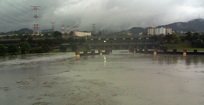
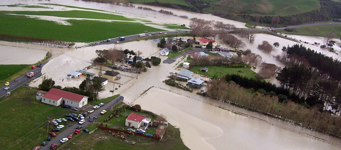
Cities in flood-prone areas have much to gain from effective flood forecasting, because they have so much to lose through flood damage to property and business.

A city’s protection against the impacts of a major flood or frequent flash flooding depends on prior prediction of the timing and severity of the event. It is flood forecasting that provides the warning time needed to activate flood management plans.
In a changing climate in which the intensity and frequency of flood events in many parts of the world is predicted to increase, flood forecasting is a critical component of building climate resilience.
KL gets SMART about flash flooding
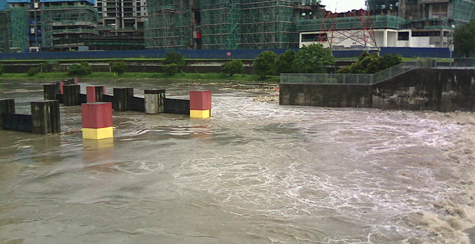
Kuala Lumpur’s SMART (‘stormwater management and road tunnel’) project is an innovative flood protection solution incorporating state-of-the-art flood forecasting and detection along with South-East Asia’s longest dual-purpose tunnel.
Kuala Lumpur is Malaysia’s biggest and fastest growing city, built at the confluence of two major rivers. Flash flooding in the city centre causes significant damage and risk to lives and livelihoods. The lost business, damage and clean-up activities caused by these flood events have resulted in significant economic losses.
A number of serious flood events occurred in the years before the SMART project was commissioned, and in its decade of operation since 2007 there have been on average 23 moderate storms per year and around 9 severe or prolonged flood events per year. These would very likely have caused major impacts if the SMART project were not operational.
The idea behind the SMART project is to prevent flash flooding in the city during a typical flood. Floodwaters are diverted away from the city via holding ponds and a tunnel, and then discharged into a river downstream of the city. The infrastructure doesn’t sit idle in dry times – a section of the tunnel is used as a motorway, with two decks of traffic, relieving growing levels of traffic congestion.
The tunnel operates in three modes. Most of the time, when there is little rainfall, there is no discharge of water into the tunnel, which is open to traffic.
In a moderate or minor storm, the tunnel diverts some water flow through the lowest channel of the road tunnel section. The motorway section operates normally and there is no traffic disruption.
In a major storm or when a heavy and prolonged downpour is predicted, the gates at the diversion weir are lowered to divert water flow into a holding pond. Meanwhile, entrances to the motorway section are closed to traffic and vehicles in the tunnel are evacuated. Once empty of cars, the tunnel can be opened to carry a full flow of water. When the weather returns to normal, floodwater is pumped out of the tunnel, which is then cleaned of mud and debris before being reopened to traffic.
Effective protection relies on warning
The innovative and award-winning SMART system depends for its success on the effectiveness of the flood forecasting and detection system underpinning its timely operation.
In the SMART project, flood prediction and detection involve collecting, transmitting, processing and analysing data to forecast storm characteristics. Rainfall and streamflow measurement stations feed into a database and modelling system, providing sufficient warning to clear the tunnel of traffic and open the road deck gates to allow the floodwater to pass through.
The modelling system consists of a coupled hydrological/hydraulic model of the catchment, river channels and tunnel. It draws real-time information from a SCADA system, which retrieves data from instrumentation in the field. This data includes catchment rainfall, streamflow, gate position, pump operation and equipment failure.
The hydrological model is a semi-distributed conceptual rainfall-runoff model, which simulates the soil moisture levels in the catchment over time. The model runs in a warm-up mode, which uses the latest observed data, and in a forecast mode, which generates forecasts of streamflow at key points in the river network two hours into the future.
The hydrological model feeds a hydraulic model, which represents the river channels, storage reservoirs, gates and pumps, and tunnel decks. A series of operating rules for the tunnel infrastructure are programmed into the model, to allow it to adequately forecast flood levels when the tunnel is operated accordingly. The hydraulic model’s major outputs are forecasts of river heights at key locations in the catchment.
The system provides an updated forecast every five minutes, which feeds in to the decision support system for tunnel operators. It’s important that the updates are this fast and frequent to be able to capture the peaks of a catchment that responds very quickly to sudden and intense rainfall.
Modelling in a changing city and climate
The SMART flood detection system is complex and relies on a large network of data. As weather patterns change and as Kuala Lumpur continues to develop, the characteristics of the river channels can change. This means that both the hydrological and hydraulic models must be frequently updated to adequately reflect changes in the systems they represent, such as changes to the catchment, channels, or operation of the SMART tunnel. It is also important to record the history of these changes for calibration against historical flood events.
New developments
The SMART project has a proven track record of mitigating floods in Kuala Lumpur’s city centre; however, operating costs can be high. This includes energy costs for pumping, and the cost of cleaning the tunnel after a successful flood diversion. A review of the flood operating rules is planned for 2018. Revised rules will optimise the operation of the tunnel, to minimise operating costs while still defending the city against flash flooding.
Kuala Lumpur’s robust and accurate flood forecasting and detection system now provides the vital timely warning of floods and their magnitude so that the SMART tunnel can operate successfully to mitigate flood impacts throughout this important city.
It’s a great example of the potential for flood forecasting to save millions of dollars in flood damages, whether in a major metropolis, regional town or rural area anywhere in the world.
To discuss how Entura can help you better manage your flood-related risks, contact Bill Cohen on +61 3 6245 4513, Phillip Ellerton on +61 439 010 172 or Shekhar Prince on +61 412 402 110.
About the author
Bill Cohen is a hydrologist at Entura. He has more than six years of experience in areas of computational hydrology including hydrologic modelling, flood forecasting, and flood estimation. He has been involved in the design and development of flood forecasting systems in Australia and internationally, and has presented at a number of international conferences in recent years.
MORE THOUGHT LEADERSHIP ARTICLES
Key considerations for better flood forecasting
Flood forecasting is critical for protecting infrastructure and public safety.
In potentially catastrophic events, effective warnings save lives and avoid costly impacts on property, infrastructure, communities and the environment.
Effective flood forecasting systems provide accurate and timely warning of impending floods . Longer warning times provide greater opportunity to activate emergency management or evacuation plans and to manage water infrastructure.
Successful flood forecasting has obvious applications such as enabling informed operation of a dam to minimise flood peaks downstream, helping determine the need for emergency evacuation, managing river water quality within licensed limits, strategically operating hydropower stations to maximise power generation, or informing the timing or methods of major construction projects such as dams and bridges.
Flood forecasting systems
Flood forecasting systems simulate, display and communicate flood generation processes in a catchment. At the heart of a forecast system is the hydrologic model that converts real-time measured rainfall data and forecasts from weather forecasting agencies or numerical weather prediction (NWP) models into runoff and flow in rivers, or inflows to storages.
For some applications, the hydrologic models can be coupled with hydrodynamic models of the river and surrounding area to provide more accurate representations of flood levels and inundation areas. The forecasts can be displayed graphically on dashboards or mobile phone applications, and automated alerts and warnings can be sent to operators and water managers to manage flood risks.
Warning times and UNCERTAINTIES IN Flood FORECASTING
The chances of effectively managing flood risks improve with longer warning times . However, there is a trade-off between achieving longer forecast warning times and forecast accuracy.
Forecast accuracy depends on the availability and accuracy of the input data (rainfall data, forecasts, and flows) as well as the ability of the hydrologic and/or hydrodynamic model to accurately simulate flood producing mechanism in the catchment.
Flood forecasts based on real-time measured flow data are the most accurate, but they often cannot provide adequate warning times for effective management of flood risks.
Forecasts using observed rainfall data provide slightly longer warning times but also introduce uncertainties. This is because the hydrologic models used to convert rainfall to runoff are a simplified representation of the catchment. They cannot possibly represent all the intricate flood-producing processes that occur in nature.
Warning times are increased by up to a week or more using forecast rainfall data. However, rainfall forecasts are generated using numerical weather prediction models (NWPs) which simulate complex and chaotic processes occurring in the atmosphere and are prone to greater errors and uncertainties.
Despite greater uncertainty, longer term forecasts can indicate that a water manager should keep watch for the possibility of a flood, and can offer more time to ensure that the correct procedures are in place to manage a potential flood risk, and to take actions such as optimum storage management to capture floods.
Importantly, the uncertainty associated with the forecast at longer warning times should be recognised and estimated. Quantification and communication of uncertainty in forecasts provides additional confidence for making decisions about water management.
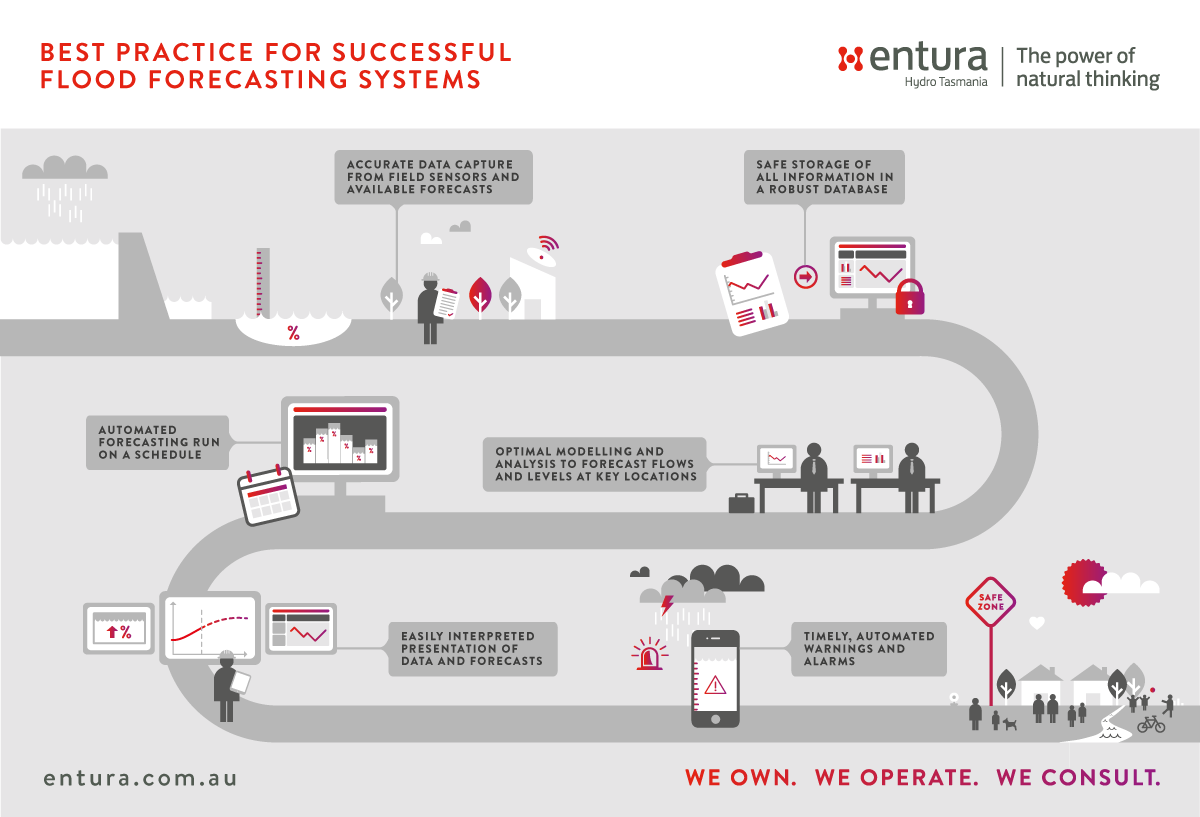
Seven attributes of superior flood forecasting systems
Investment in a flood forecasting system will provide the best access to the timely, accurate information a water manager needs in adverse conditions.
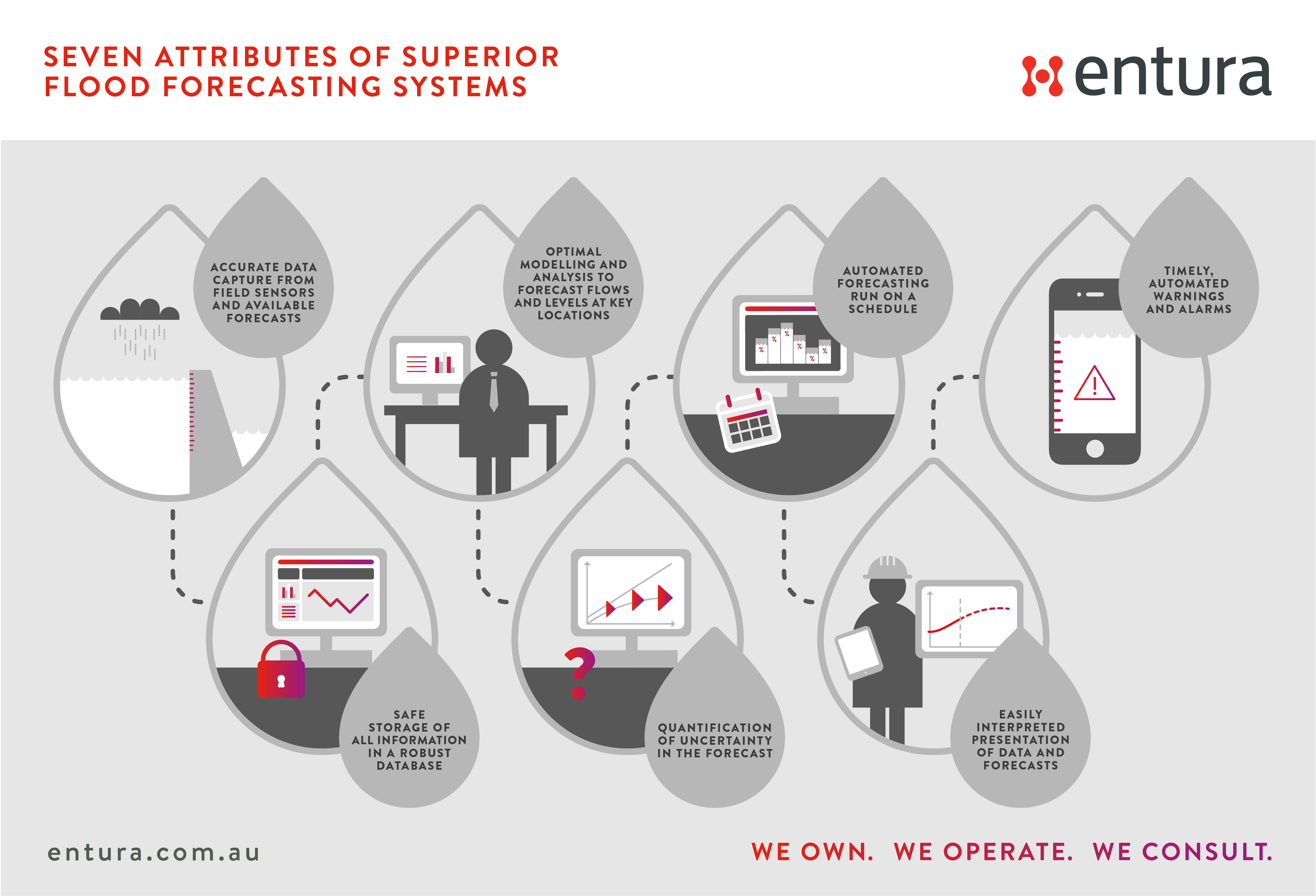
Click the image to download infographic.
Entura’s flood forecasting approach involves effective data capture, storage, modelling and dissemination of information. Let’s take a closer look at the features of an optimal flood forecasting system:
|
Accurate data capture from field sensors and available forecasts
|
Data collection sites for flow, rainfall and water-level information must be properly maintained, and any problems with sensors quickly addressed. Automated quality checking is needed to detect major data errors or missing data. There should be redundancy in the network, and routines within the modelling should allow for infilling with data from other sites if one site is out of service. Ideally, a range of possible rainfall forecasts would be included in the modelling to indicate uncertainty in forecast rainfall amounts. |
| Safe storage of all information in a robust database | Storing all data used in forecasting, and the forecasts themselves, allows analysis of the suitability of the input data for forecasting, and analysis of the accuracy of forecasts. Comparison of forecast and actual data can be used to adjust the models. |
|
Optimal modelling and analysis to forecast flows and levels at key locations
|
Hydrologic and hydrodynamic modelling provide flows and water levels at critical points in the system, such as an inflow to a storage, the water level in a reservoir, the water level along a river, or an inundation area in a town. Models should be reviewed periodically with the most recent data to ensure that the parameters are still optimal and that the forecasts are performing as expected. |
| Quantification of uncertainty in the forecast | Ideally, forecasted inflows and levels should be accompanied by indications of the accuracy of the forecast. These are achieved by quantifying uncertainty in the forecast using statistical models and represented as high and low confidence intervals or assignment of probabilities to the forecasts. |
| Automated forecasting run on a schedule | The forecasting system should be fully automated, with the ability to run more frequently in a flood situation if required. Where practical, the system should be fully redundant. A stand-alone system operable with manual data inputs can provide back-up if all communications to a site are lost. |
| Easily interpreted presentation of data and forecasts | Operators and managers need to be able to easily interpret forecasting outputs to make decisions. The visualisation of the data should be tailored for the individual user and include an indication of certainty. Displays may include maps of forecast inundation areas, forecast river levels and flows, or rainfall over a catchment. |
| Timely, automated warnings and alarms | Automated alarms and warnings alert water managers of any forecast floods that may exceed critical thresholds, providing time to ensure appropriate preparation and action. |
In an increasingly volatile climate, with the likelihood of more extreme flood events, an effective flood forecasting system is a critical investment for water managers.
To discuss how Entura can partner with you to develop a best-practice flood forecasting system to help you better manage your flood-related risks, contact Phillip Ellerton on +61 439 010 172 or Shekhar Prince on +61 412 402 110.
MORE THOUGHT LEADERSHIP ARTICLES
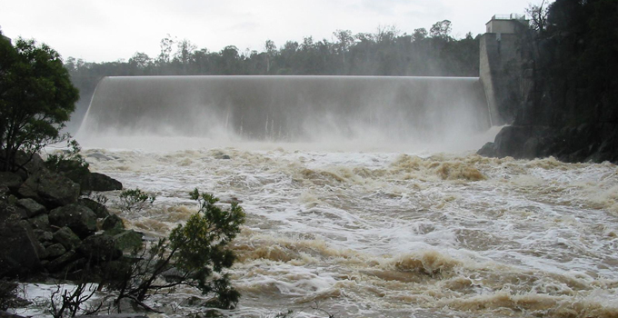
Flood forecasting for a safer dam upgrade
An effective flood forecasting system is a vital tool for managing the significant risks that floods pose to communities, infrastructure and the environment.
If you can clearly understand the likelihood and scale of potential flooding and get accurate and timely warnings, you can better manage water infrastructure and implement safety plans in time to protect assets and communities at risk.
For hydropower businesses such as Hydro Tasmania, flood forecasting is a critical part of managing dam risk. Specialist power and water consulting firm Entura provides real-time inflow and flood forecasting and data management solutions to help manage Hydro Tasmania’s extensive catchments and 55 major dams.
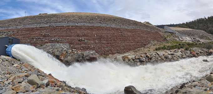
Our most recent example of the risk-reducing benefits of flood forecasting systems is the major upgrade in 2014–15 of the Rowallan Dam on the Mersey River in Tasmania’s north, first built in 1968. The 43m-high earth and rockfill dam needed total refurbishment to be sure of a long, safe future.
Significant work was needed to bring the dam up to modern engineering standards and to increase its capacity to withstand large floods. To complete the necessary upgrade works, Rowallan Dam had to be excavated from crest to foundation on both sides of the spillway walls, exposing the heart of the dam.
The Rowallan Dam flood forecasting system allowed operators to confidently manage the flood risk during construction, ensuring the safety of construction workers and the public downstream, and protecting infrastructure and the environment from major flood damage.
The need for flood and lake-level forecasting at Rowallan Dam
During the construction phase of the major upgrade, Rowallan Dam faced a higher than normal risk of exposure to floods. Overtopping of the temporarily lowered dam crest during construction would compromise dam safety.
Kim Robinson, Senior Hydrologist and Project Manager for the Rowallan Dam flood forecasting system, said “This work was unprecedented in Australia because it was undertaken on a live dam, holding back Lake Rowallan – with a capacity of 130 000 megalitres.”
Kim explained that forecasts of lake levels were needed so that Lake Rowallan could be kept at the appropriate target level during the major excavation and refurbishment works. For safe work, the lake level needed to be lowered significantly by periodically opening a bypass valve to release water from the lake.
“The lake level needed to be low enough for safety, while also not losing too much valuable water, and potential revenue, by releasing too much water through bypass valves rather than through the power station,” Kim said.
As well as the required forecast of lake levels, a flood forecast was needed to indicate when emergency backfilling of the dam crest may be needed.
“The sensitivity of when to trigger this kind of action was a particular challenge” said Kim. “If backfilling was not carried out in time and a flood breached the construction works, the dam would be at risk of failure, with serious consequences for the storage downstream and potential impacts on communities.”
On the other hand, triggering an emergency backfill would be likely to delay construction by a year, with large financial impacts. “Backfilling is expensive and would risk extending the construction period into the wet season and the following summer,” said Kim, “which would be very costly both in terms of construction and from losing water that could have been used to generate power”.
A robust, effective flood forecasting solution
The solution to maintaining optimum lake levels and flood preparations during the Rowallan Dam upgrade was to develop a best-practice flood forecasting system, combining measured data from sensors at key locations with rainfall forecasts from weather forecasting agencies into a hydrologic model of the catchment.
“The modelling predicted lake levels and the time it would take for water to reach critical levels that could jeopardise the dam, always ensuring sufficient time for emergency backfilling,” Kim Robinson said. “The critical level varied depending on the depth of construction works, and maintained the same level of flood risk at all times.”
The entire modelling process ran automatically and provided an updated forecast every two hours during the construction period. Plots were developed showing the best-estimate forecast of inflow and lake level and rainfall over the catchment. The operators and construction managers used these plots to guide the operation of the valves to keep the lake at appropriate levels and to ensure appropriate preparation for emergencies.
Kim Robinson explained that alerts were set to trigger if the forecast exceeded the critical level. Plots were disseminated continually via email and a website. In an emergency, SMS and SCADA flood alerts would be sent out to relevant parties. If a flood alert was issued, the dam safety emergency plan would be activated.
“The system was made more robust by building in redundancies in the modelling and developing a stand-alone system at the dam site that did not require continuous connection to the database. This could be used if communications with the dam site were lost,” said Kim.
Striving for accuracy and certainty
For users to have confidence in the outputs of the flood forecasting system, it was important that the input data and hydrologic modelling were as accurate as possible, and that the level of certainty of the forecasts was clear.
“A plan was put in place to ensure that critical rainfall and flow gauges for the modelling were operational and that any maintenance required was undertaken within strict timeframes,” Kim Robinson said. “We developed routines to automatically check all input data for errors or missing data, and send alerts if inconsistencies were detected.”
Kim explained that the flood forecasting outputs included indications for operators of the uncertainty of both the rainfall forecasts and the modelling. “We developed the rainfall forecast uncertainty measures by comparing forecast rainfall to rain-gauge data over a historical period. The model uncertainty was estimated by running the model over a historical period with historical rainfall as input, and comparing outputs with measured lake levels,” he said.
The model has permanent ongoing value to the business and is being transitioned into the ongoing inflow and flood forecasting system which is used by Hydro Tasmania to manage power generation and dam safety risk. Learnings from this project are also being rolled out across the rest of a forecasting system which produces forecasts for 31 storages across Hydro Tasmania’s portfolio.
To discuss how Entura can partner with you to develop a best-practice flood forecasting system to help you better manage your flood-related risks, contact David Fuller on +61 438 559 763, Phillip Ellerton on +61 439 010 172 or Shekhar Prince on +61 412 402 110.
MORE THOUGHT LEADERSHIP ARTICLES
Buying time: managing risks with flood forecasting
Almost every day, somewhere in the world, floods are putting lives at risk and causing major damage and financial impacts to buildings, critical infrastructure, agricultural land and crops, and the environment.
In 2013, almost 10 000 people were killed worldwide by flooding, and the lives of more than 32 million people were adversely affected by flood disasters. In Australia alone, the estimated cost of flooding is $400 million per year, and around the world the costs rise into the billions.
If you understand the specific risks and consequences of flooding in your location and area of operation, you can implement suitable emergency action plans to best manage these potentially catastrophic events, saving lives, reducing costs, and minimising impacts on property, infrastructure, communities and the environment.
Flood forecasting is a vital component of a total flood warning system. With increasing severity and frequency of extreme weather events likely in the future, effective flood forecasting systems are urgently needed to provide the accurate and timely warning of impending flood events that will improve public safety and minimise flood-related damage and costs.
Flood forecasting systems allow you to manage risk
Flood forecasting systems can be used by local authorities, water managers and owners of water assets to better manage a range of risks. By providing warning time of an impending flood, forecasting systems offer a window of opportunity for good decision making to reduce public safety risk through warning or evacuation, and to ensure informed management of water infrastructure.
Whenever a large volume of water is held or is transferred under pressure, potential risks to public safety and downstream infrastructure arise. The normal operations of water assets such as dams, pipelines and hydropower facilities regularly involve potential risks to the safety of both the general public and staff involved in construction, operation and maintenance. In this context, successful flood forecasting has obvious application, such as allowing operation of a dam to minimise flood peaks downstream, informing the timing or method of dam construction to avoid inundation of the works, or helping determine the need for emergency evacuation.
Sometimes flood risks can also be opportunities, if managed carefully. Flooding offers the gift of abundant flows to owners of hydropower assets or water supply or irrigation storage facilities. In this context, flood forecasting can provide strategic operational benefits to water managers by providing enough warning of impending large flows to allow optimal preparation for capturing, storing and using the plentiful water.
How are floods predicted?
Flood forecasting systems combine measured rainfall data and rainfall forecasts from weather forecasting agencies into a hydrologic model of a catchment. This model converts the rainfall into runoff and flow in rivers, or inflows to storages. These flow forecasts can be corrected with measured flow data in real time where this is available.
For some applications, these flows provide inputs to a hydrodynamic model of the river and surrounding area to give forecast flood levels and inundation areas.
The forecasts can then be displayed graphically or in another appropriate format for operators and water managers to use to manage flood risk.
The accuracy of flood forecasting depends on both the accuracy of the input data (rainfall, forecast rainfalls and flows) and the accuracy of the hydrologic modelling.
There is a necessary trade-off between forecast times and accuracy. The most accurate forecasts are based on measured flow data, but this gives very little warning time as the flows are already in the river. Forecasts based on conversion of measured rainfall to runoff using models give longer warning times but greater uncertainty. The longest warning times are achieved using forecast rainfall data, but these forecasts are the least certain.
Despite greater uncertainty, longer term forecasts can indicate that a water manager should keep watch for the possibility of a flood, and can offer more time to ensure that the correct procedures are in place to manage a potential flood risk, and to take actions such as optimum storage management to capture floods.
Best practice for successful flood forecasting systems
Successful real-time flood forecasting relies on capturing and storing accurate input data, reliable modelling, easily interpreted results, and timely alerts and warnings. Best-practice flood forecasting systems should include:
|
Accurate data capture from field sensors and available forecasts
|
Data collection sites for flow, rainfall and water-level information must be properly maintained, and any problems with sensors quickly addressed. Automated quality checking is needed to detect major data errors or missing data. There should be redundancy in the network, and routines within the modelling should allow for infilling with data from other sites if one site is out of service. Ideally, a range of possible rainfall forecasts would be included in the modelling to indicate uncertainty in forecast rainfall amounts. |
| Safe storage of all information in a robust database | Storing all data used in forecasting, and the forecasts themselves, allows analysis of the suitability of the input data for forecasting, and analysis of the accuracy of forecasts. Comparison of forecast and actual data can be used to adjust the models. |
| Optimal modelling and analysis to forecast flows and levels at key locations | Hydrologic and hydrodynamic modelling provide flows and water levels at critical points in the system, such as an inflow to a storage, the water level in a reservoir, the water level along a river, or an inundation area in a town. Models should be reviewed periodically with the most recent data to ensure that the parameters are still optimal and that the forecasts are performing as expected. |
| Automated forecasting run on a schedule | The forecasting system should be fully automated, with the ability to run more frequently in a flood situation if required. Where practical, the system should be fully redundant. A stand-alone system operable with manual data inputs can provide back-up if all communications to a site are lost. |
| Easily interpreted presentation of data and forecasts | Operators and managers need to be able to easily interpret forecasting outputs to make decisions. The visualisation of the data should be tailored for the individual user and include an indication of certainty. Displays may include maps of forecast inundation areas, forecast river levels and flows, or rainfall over a catchment. |
| Timely, automated warnings and alarms | Automated alarms and warnings alert water managers of any forecast floods that may exceed critical thresholds, providing time to ensure appropriate preparation and action. |
Applications of flood forecasting systems
Flood forecasting is a critical part of managing dam risk and public safety risks across a dam portfolio. As part of Hydro Tasmania, Australia’s largest water manager and renewable energy producer, specialist power and water consulting firm Entura provides real-time inflow and flood forecasting and data management solutions to help manage Hydro Tasmania’s own extensive catchments and a complex system including 55 major dams.
We’ve built on our experience in dam safety to offer flood forecasting expertise to a range of clients throughout the Asia-Pacific region for other important applications, such as providing the advanced flood warnings needed to protect assets and communities at risk, whether in regional areas or large metropolises.
To find out more about how Entura can partner with you to develop a tailored and complete solution to help you better manage your flood-related risks, contact Phillip Ellerton on +61 439 010 172 or Shekhar Prince on +61 412 402 110.


