Flood study for a Tasmanian council

Client: A Tasmanian local council
Location: Tasmania / Australia
Date: 2023 - 2024
Understanding flood risks and assessing mitigations to protect a local sports field and park
Background
Entura was engaged in 2023 to conduct a flood study for a local council in southern Tasmania, to understand the current flood risks at a park and sports field and assess up to 3 potential flood mitigation options to protect these community assets.
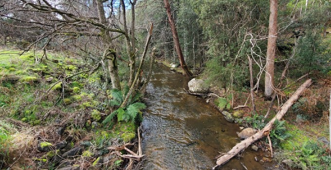
The bank of the river adjacent to the sporting field is frequently overtopped during flood events, leaving debris and gravel on the playing surfaces and damaging nearby roads and pathways. The local council is responsible for the time-consuming and costly task of clearing the debris and remediating the grounds.
Solution
Entura’s specialists undertook a hydrological and hydraulic assessment of an approximately 100 km² catchment upstream of the sports field for the 1 in 100 AEP future climate event (2100) using a two-dimensional hydraulic model (TUFLOW). Rainfall was applied directly onto the catchment for the considered flood event, and losses were modelled using soil layers with assigned permeabilities.
A challenging aspect of this project was verifying the hydrologic results (i.e. the flow rate through the river adjacent to the sports field) because the catchment is ungauged. To overcome this challenge and build confidence in the model results, we compared outputted flow rates to values estimated using the Regional Flood Frequency Estimation model. The hydraulic behaviour was verified by simulating a recent flood event and comparing the model results (including flood depths and inundation extents) with photos taken during and after the flood event.
Using the results of our study, we proposed some flood mitigation options to protect the sports field from flooding, including levees and/or upgrading underground stormwater works. Each flood mitigation option was compared against a flood protection criterion to propose a preferred option to our client.
Another challenge was the cost of the preferred solution as the levee height required to protect the park from flooding was significant due to the large catchment upstream and the low elevation of the park located at the catchment outlet. To overcome this, Entura proposed a revised flood protection criterion that is more appropriate for the nature of the project and reduced the initial height of the levee. This revised option will still allow for further levee raising in the future to protect against rarer events.
A key learning from this project was the quantifiable estimate on the impact of climate change on flood mitigation projects and how solutions need to consider additional/higher floodproofing to combat increases in rainfall intensity and sea level rise, and to determine how these can be staged.
Services provided
- Hydrological and hydraulic assessment
- Flood mitigation options
Outcome
Our studies have given our client a clear understanding of the current flood risks to the park, the possible mitigation options to protect it from a 1 in 100 AEP 2100 flood event, and a high-level estimate of the quantities required for the mitigation options. This will enable our client to assess which options are most practical and cost-effective.
The value of our work has potential to extend beyond this project and deliver greater benefit across the entire catchment. Our hydraulic model can be used to estimate flow velocities and depths across the catchment, which can assist in understanding other areas prone to erosion and flooding (not just the park itself) and support efforts to reduce erosion and protect the local environment.


