King Island wind turbine verticality survey
Client: Hydro Tasmania
Location: Tasmania, Australia
Date: 2023
Terrestrial laser scanning to confirm the condition of wind turbines and inform decisions about their future
Background
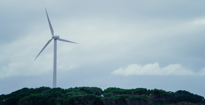
On King Island in Bass Strait (between Tasmania and mainland Australia), wind turbines play a crucial role in the island’s hybrid off-grid renewable power system. The 3 oldest wind turbines were installed in 1998, and 2 more were installed in 2003. The turbines are at a stage in their lifecycle where significant decisions are needed about their management, maintenance and operational life.
One critical input to any decision-making is ensuring the verticality of the turbine towers – that is, checking that the towers still remain perfectly upright within the tolerances specified by the manufacturer. Even small deviations could affect the performance and long-term integrity of the turbine. Entura’s survey and spatial team was engaged to carry out this precision work on 2 large towers.
Solution
Visiting the island in 2023 and returning again in 2025, our surveying specialists used state-of-the-art terrestrial laser scanning to create accurate 3D models of each tower. These models were then sliced every 0.5 m vertically up the tower, enabling the team to compare the tower’s shape against a perfectly vertical line from the centre of the base, in both the north–south and east–west directions. This approach provided a detailed, high-resolution assessment of any lean or tilt in the towers in any direction.
Outcome
Delivering results quickly was critical. Hydro Tasmania needed timely data to decide whether the turbines could continue operating safely and efficiently or if maintenance interventions were required. The survey confirmed that both towers were still within the manufacturer’s verticality specifications – providing confidence in their ongoing operation and informing the strategy to safely extend the turbines’ lifespan.
Reflecting on the project, Matt Reid commented, 'One of the challenges of capturing precision data on assets as large as wind turbines and in such a remote location was arranging quick and efficient transport of heavy equipment to the island. The quick data turnaround was critical to the project and the team showed ingenuity, both onsite and in the office, in the techniques used to orientate and process the data, providing clear answers to the questions asked of the project.'
By combining advanced spatial technology with rapid analysis, we were able to generate a fuller picture of the assets, enabling better analysis. The results have helped Hydro Tasmania proactively manage structural integrity, reduce operational risk and support ongoing sustainable energy production from these assets.
'What we really appreciated from Entura was the ability to visualise the verticality of the towers,' a client representative said. 'The deliverables allowed not only the overall verticality to be assessed and visualised easily but also allowed for assessment of the change in verticality across the entire tower. Ultimately, access to precision data like this gives us much more confidence in the decisions we need to make about aging infrastructure so we can keep delivering reliable, secure electricity to our remote communities.'


